 Our cities are convoluted messes. Designing them to operate smoothly before breaking ground is a challenge surpassed only by the task of keeping track of their many moving parts, which seem to fly by at a breakneck speed once the final brick has been laid. The dizzying complexity of our cities escapes our comprehension, yet an exponentially growing number of people call these sprawling hives of concrete, steel, and glass their homes. Roughly 56% of the world’s population currently lives in cities according to the World Bank, which projects that by 2050 that figure will climb as high as 70%. With out of control urbanization posing a direct threat to the earth’s already endangered ecosystems, it is critical that we use every tool imaginable to design our cities to be more sustainable and livable for the generations to come. Of all the tools that can help us more clearly visualize and manage the cities of tomorrow, City Information Modeling (CIM) is one of the most powerful.
What Is City Information Modeling (CIM)?
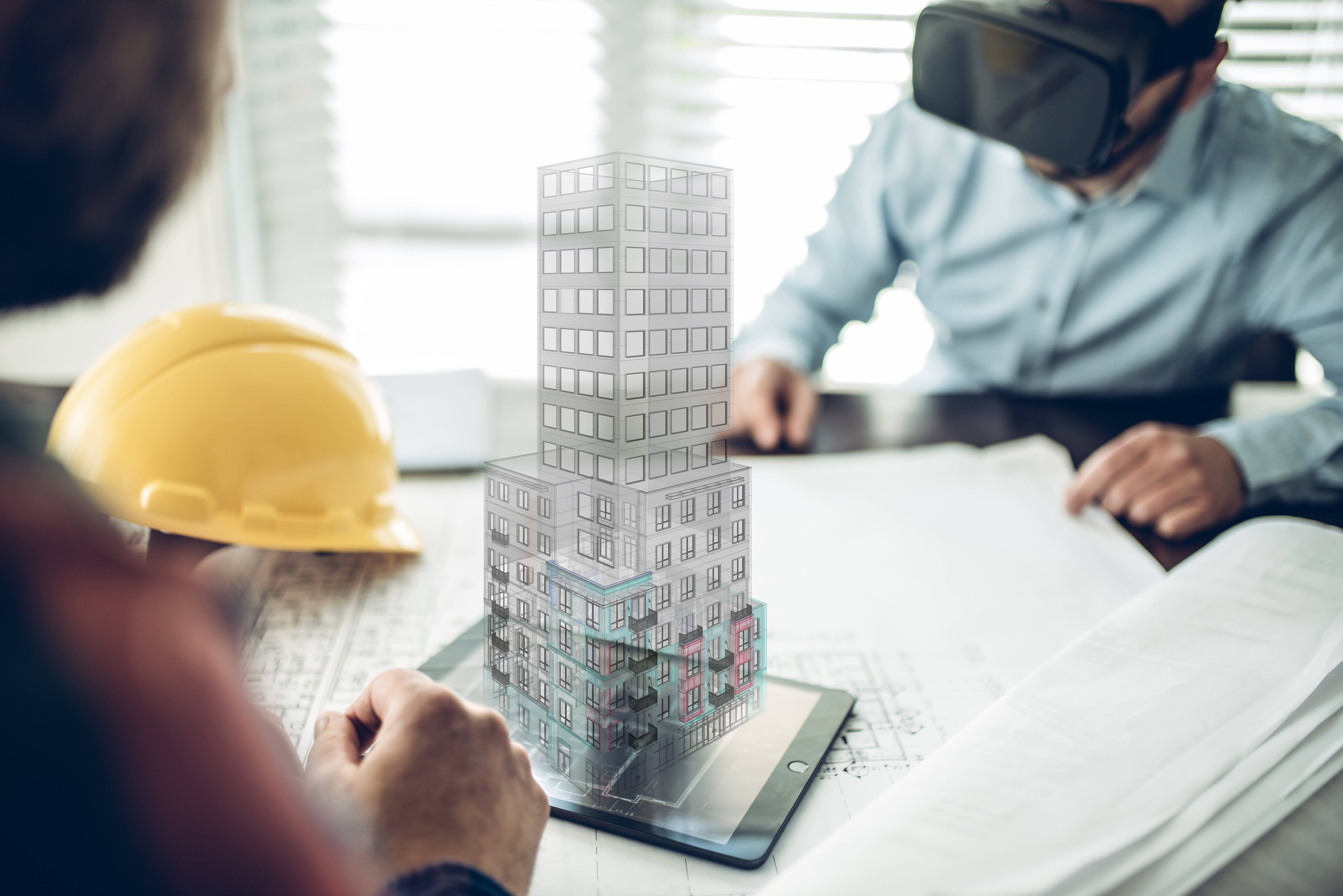
Before we define CIM, let’s run through a quick refresher on its closest relative: BIM. Building Information Modeling (BIM) is a digital process of creating highly interactive three-dimensional models of individual structures. A cutting edge technology that’s opened up whole new career fields in the construction industry, BIM has eclipsed CAD as the preferred method of project design over the last ten years or so. Indeed, we have reached a point where almost 100% of US based architecture firms have adopted BIM.

City Information Modeling (CIM) is the next logical leap forward. Think of these two technologies as videogames. BIM is SimTower and CIM is its sequel, SimCity. The first deals with the construction and management of individual virtual buildings while the second expands on those principles to deal with entire cityscapes. City Information Modeling (CIM), also known as Civil Information Modeling or Construction Information Modeling, takes data collected from a variety of sources and weaves it all together to create a highly interactive 3D model of large-scale urban environments. Everything from above ground structures to below ground infrastructure is included in the model. Though not yet as universally established as BIM, CIM is poised to revolutionize how the cities of the near future are planned, designed, and operated.
Like BIM, the 3D metropolises built within the virtual sandbox of CIM offer more than just flashy graphics. At its highest level of function, CIM acts as a kind of library that contains within it every conceivable piece of information about the city that it represents. Do you want to know the population density of a particular city block? How about how traffic patterns affect commerce or real estate prices? What’s the combined carbon footprint of this cluster of buildings? How will changing weather events impact different areas of the city? All of these questions and more can be answered within CIM. Aside from modeling existing appearances, CIM also provides an integrated virtual platform in which any component of a city can be altered and analyzed. These capabilities make CIM an invaluable tool for architects and engineers who are looking to creatively design urban centers that generate specific outcomes, whether it’s increasing walkability or improving the efficiency of stormwater removal.
How Does CIM Work?
This probably doesn’t come as a surprise but creating an accurate model of a whole city is a little more complicated than modeling a single building. To pull off this feat, CIM must seamlessly integrate a variety of datasets collected from several different sources. The number and nature of those sources can change depending on the specific project, but for our purposes, we’ll be taking a look at just these four pieces of the puzzle: GIS, BIM, LiDAR, and IoT.

When building a virtual model of an urban environment with CIM, the first thing you’ll want to do is take a look at the GIS, or Geographic Information System. This is a digital mapping tool that’s used to store spatial, historical, and institutional information about land, buildings, and properties. GIS can be helpful in the CIM process for identifying the precise locations of structures in relation to each other. GIS also provides a foundation of basic visual and historical data upon which the rest of the CIM model can then be constructed, placing the virtual city within the proper context of its surrounding geography.
The next thing to do is to consider the role of BIM. If you’re building a whole new city from scratch, the best way to capture the most detailed picture of each and every structure is to build them first with BIM. Now let’s say you’re working in an area of an already existing city where there are a lot of newer buildings that were previously designed and built with the aid of BIM. That is to say, each of these newer buildings already has its own designated 3D model populated with a host of graphical and non-graphical data about its various systems and performance. In this case, creating a data rich 3D model of the whole area is as simple as integrating all these already existing BIM files into the shared virtual space of CIM. This way, your CIM model not only captures the history and two-dimensional footprint provided by GIS, it also includes a highly interactive 3D representation of each building, offering greater opportunities for deep analysis and playing with theoretical alterations to the urban environment as an interconnected whole.

Instead of erecting an entirely new city, perhaps you’re looking to improve or add on to an already existing urban area. The thing is that most cities and towns are mixes of new and old architecture. Older buildings that were erected in the time of pen-and-paper blueprints are likely stored in GIS but they don’t have BIM files or other detailed digital records of how they function over time. You want your virtual city to be comprehensive but the lack of BIM files for older buildings presents a challenge. Thankfully, it’s not an insurmountable one. One solution is to use rapid-scanning technologies like LiDAR (Light Detection and Ranging) or photogrammetry to capture the internal and external geometries of the structures. From here you can create 3D models of the older buildings that can then be easily plugged into the CIM model. In other words, LiDAR can be used to reverse engineer a makeshift BIM model of already existing structures. Later, a detailed survey of the older buildings’ internal HVAC, plumbing, and electrical systems can be conducted to flesh out their new 3D counterparts in the CIM model.

Now that you’ve got a handle on how BIM, LiDAR, and GIS can be used to assemble the nuts and bolts of a virtual city, the next thing to do is to imbue that virtual city with a spark of life. IoT, or the Internet of Things is a term that describes the myriad of devices and everyday objects that are linked to the internet. Embedded with microsensors and tiny onboard computers, these objects automatically collect and share data with each other and the distributed cloud-based networks that tie them all together. The so-called “internet of things” has exploded in recent years as more and more of our appliances and gadgets are outfitted with built-in wireless internet connectivity.
For example, consider how One-Key uses Bluetooth Low Energy (BLE) in order to build a network of multiple low output devices, connected in the Internet of Things, and transfer small amounts of data without drawing too much energy.

Cities have increasingly incorporated the IoT into the built environment as well, deploying sensors to track everything from vehicles on the roadways to foot traffic in commercial areas. A familiar example of this technology in the wild is the way GoogleMaps tracks the movements of our phones to monitor traffic congestion. The collected data from all these inputs can be fed into the 3D virtual space of CIM and used to automatically track and analyze real-time activity within real-world cities. This capability transforms CIM from a merely static representation to a dynamic simulation that changes over time and responds to human behavior.
What Are the Benefits of City Information Modeling (CIM)?
As BIM did before it, CIM opens up a whole new world of possibilities for both the people who build cities and those who end up living in them. Here’s a brief rundown of some of the benefits that CIM brings to the table.
Design for Specific Outcomes
The simulated nature of CIM allows architects and engineers to play with and test different design alternatives at an unprecedented level of clarity and insight. Creative architecture that encourages seamless walkability can be explored alongside the modeling of renewable energy technologies.

What surfaces of the city receive the most wind and sun throughout the day, and to what extent can they be utilized to provide power to a wind and solar based electrical grid? In what ways can buildings and infrastructure be designed to have the lowest possible impact on the surrounding environment? CIM can be used to answer all these questions and more, providing a virtual sandbox for designing cities that are more livable, accessible, sustainable, and equitable to everyone who lives, works, and plays within them.
Data-Driven Decision-Making
Cities are complex layer cakes of interlocking systems. Figuring out how all these systems interact with one another is a monumental task. CIM bridges the gap by providing a unified visual platform that synthesizes and forms associations between otherwise disparate and difficult to fathom datasets.

Users of CIM could, for instance, quickly analyze the complications of a city’s public transportation system then zoom out to discern how individual bus routes might be affected by scheduled road construction. Making this kind of data easily accessible improves logistics, boosts efficiency, and enables enhanced decision making based on concrete granular facts rather than best practices or theoretical conjecture.
Democratizing the City
Imagine being able to explore, analyze, and even participate in the design and management of an entire city from the screen of your smartphone. The 3D photogrammetric tapestries of GoogleMaps’ Street View offer a rudimentary version of at least part of this experience already, but CIM has the potential to take it to a whole new level. Virtual cityscapes built within CIM could be made accessible to ordinary people, who could then use the open-source 3D model for a variety of purposes, including enhanced access to public services and as a repository of suggested improvements to the urban environment.

Citizens could use CIM in the early stages of city planning to take part in the design process, providing input alongside architects and engineers on what features and amenities they find most desirable. The transparency provided by CIM could also have implications for what kinds of policies and laws are pursued within a city’s borders.
Toward the “Smart” City
At the moment, so-called “smart cities” are all the rage. These IoT enabled metropolises use a host of sensors and other technologies to transform physical infrastructure into digitized troves of data and automated bastions of convenience.

Whether or not the idea can deliver on all of its lofty promises is another matter but if smart cities are to be built, they will need to stand firmly on something that looks a lot like CIM. City Information Modeling offers an integrated digital foundation, a kind of fixed command center from which all the data can be collated and managed within the smart cities of the future.
What Does the Future of City Information Modeling (CIM) look like?
It will likely be another several years before CIM is as widely used as BIM. The construction industry as a whole is notoriously slow at adopting new technologies, but the benefits of CIM are too many to ignore.

Companies like Autodesk and Bentley that have been focused on BIM for over the last decade or so are slowly beginning to shift their resources to CIM. If the stars align, 3D simulations of cities like Virtual Singapore will someday be the new normal. The looming threat of climate change adds urgency to the equation. The simple truth of the matter is that we need to reimagine our cities, and fast. It may be a difficult journey, but a good first step is in the direction of the virtual cities waiting for us on the horizon.
One can’t help but wonder what Paris would look like if 19th century urban planner Baron Georges-Eugène Haussman had CIM at his disposal when he reimagined the city, transforming it from a cramped, unhealthy, crime-ridden city center to the City of Light.