Essential Strategies for Balancing Work and Life in Construction
Editorial Note: This article was brought to you courtesy of Rose Morrison, managing editor of ...


There’s a premium these days on tools that can help us make sense of where we’ve been and where we’re going. More than ever, we need a map that can guide us through the challenges of our present moment into a smarter and more sustainable future. But how are we to build such a map? Fortunately, this is not a new problem; mapping technologies have developed alongside human’s intrinsic drive to understand the current and future environment. The downside is that multiple technologies have been developed in parallel to address this. A quick search will return overwhelming amounts of information on methods and technology that can be used.
GIS and BIM are two such tools and their integration could be the key that unlocks our ability to map out the world of tomorrow. This article will explain what these two geospatial technologies are, how they can be integrated, what they can do together, and some of the obstacles that do arise with the integration of these two complex systems.
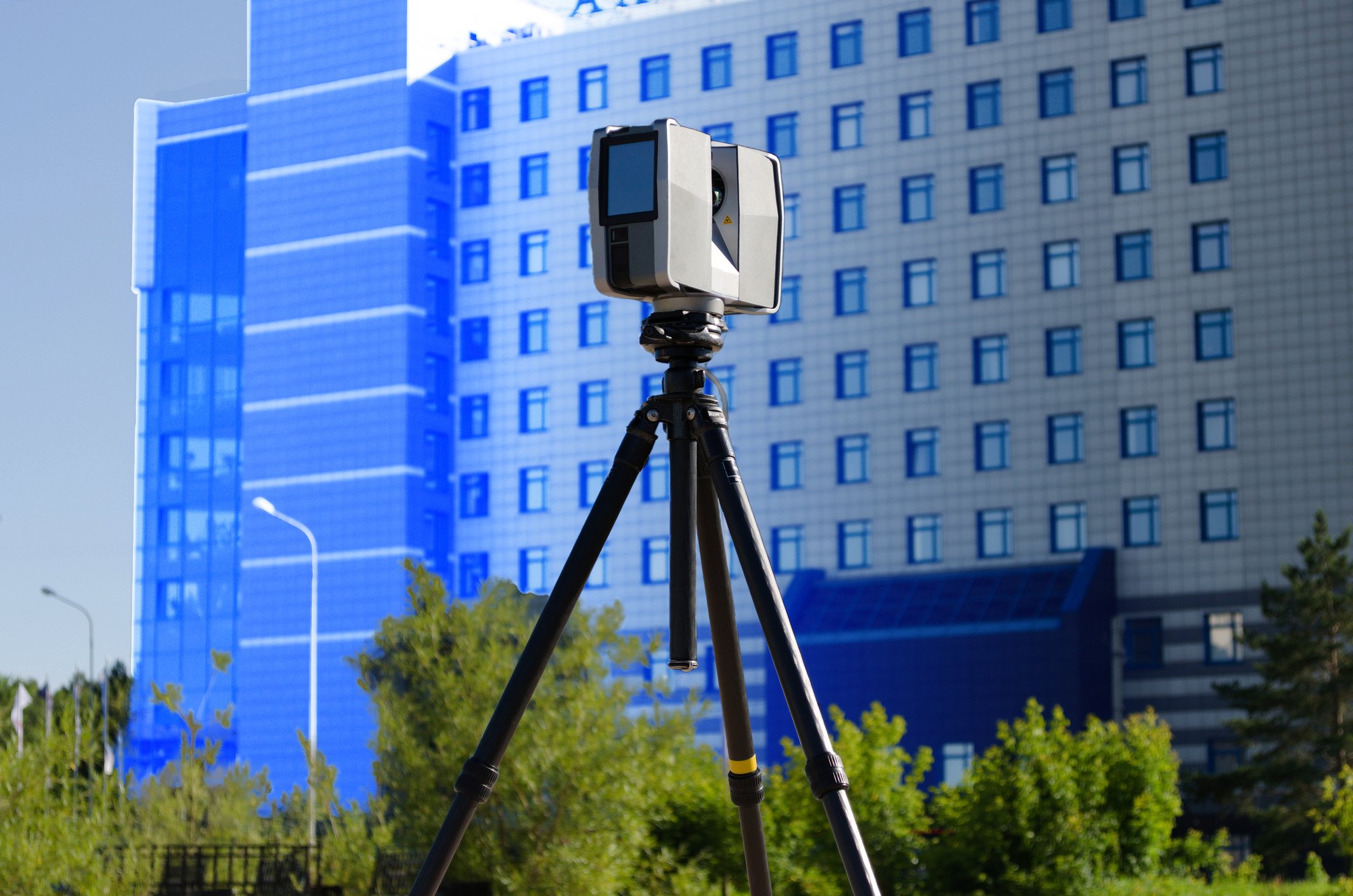
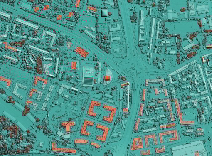
Before we can build a map of tomorrow, we’d better have a strong understanding of what’s behind the most sophisticated maps of today. GIS is short for Geographical Information System. Its history can be traced as far back as the 1800s, but the modern version wasn’t invented until the 1970s. A typical GIS setup is a computerized map that indexes massive volumes of locational data and is responsive to what the user is looking for. With GIS, you can explore the complex interlacing streams of information that flow beneath the surface of both the built and natural environments. In more nitty gritty terms, GIS refers to the collection of software and digital tools that allow users to visualize and analyze complex sets of information that are tied to a given place. It may sound abstract, but odds are high that you interact with GIS on a regular basis.
Ever used GoogleMaps to navigate from point A to point B, where you were warned about an upcoming speed trap and could check out the restaurant menu on the way? That’s GIS in a nutshell: An interactive digital map that contains multiple layers of historical, environmental, and institutional information about a place that can be adjusted in accordance with the user’s desires. Within the context of the One-Key app, consider our recently released “Tool Location History,” and how you can toggle between these features when inspecting tool and equipment historical data).
GIS applications provide an array of filters that can be added, subtracted, or stacked atop one another to provide a variety of perspectives on the vista in question. Beside the two above-mentioned applications, GIS also serves as the foundation for a vast array of free online mapping applications, including Natural Earth Data, Open Topography, NASA Earth Observatory, and even the property record database hosted by your local county government. The main idea is to enrich maps with data. Any piece of information that can be pinned to a physical location can be incorporated and catalogued into a GIS map, which can then be used much like a search engine to reveal patterns that might otherwise go unnoticed. It’s this comprehensive and open-ended quality that makes GIS such a powerful geographical tool for a wide variety of stakeholders, including government, healthcare, industrial, business, nonprofit, academic, and scientific professionals.
If GIS gives us the ability to make deep inquiries about the world as it currently is, the next step is to find something that will open a window into the world as it might be. Enter BIM, or Building Information Modeling, a more recent addition to the canon of digital geo-tech.
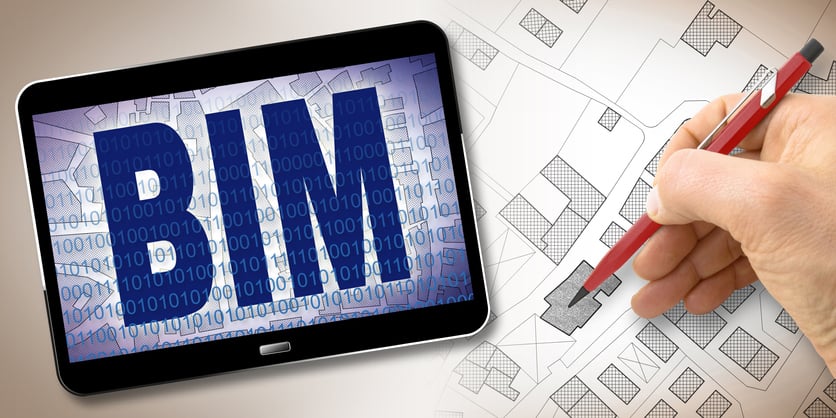
Though first conceived of in the 1970s, BIM has only reached full maturity as recently as the early 2000s, eclipsing CAD (Computer Aided Design) as the preferred design tool for the Architecture, Engineering, and Construction (AEC) industry. So what is it? What’s the big deal? Well, BIM is a collaborative computerized process that generates sophisticated three-dimensional models of yet-to-be-built structures. Imagine a virtual skyscraper that can be explored from multiple angles. Now imagine that not only the walls, floors, and ceilings are included, but deeper elements like the electrical, plumbing, and HVAC systems as well. Add in the ability to manipulate each of these layers to observe how changes to one will affect others downstream and you’ve got a pretty good idea of how BIM works. As a design tool, BIM empowers AEC professionals across multiple disciplines to collaborate like never before in the creation of highly accurate simulations of what a building project will look like and how it will behave throughout the course of its life. This last point gets to BIM’s dual functionality as a facilities management tool: once a project is completed, the BIM model can be handed off to the owners, who may then utilize it as a command center from which the structure’s vital functions can be monitored and controlled.
Now that we have a basic understanding of BIM and GIS, a nagging question might come to mind: Why integrate them at all? The shrewd reader may have noticed that both GIS and BIM have some striking similarities. At the end of the day, they’re both mapping platforms that deal heavily in data. After all, the common letter between each acronym stands for “information”. Plus, each is capable of generating complex interactive representations of actual environments. In this light, the idea of combining GIS and BIM might sound strange, like blending Coke with Pepsi or merging BluRay with its discontinued competitor, the HD DVD. Indeed, aren’t these two applications in competition with each other? If this is so, why not let them duke it out and see which one emerges victorious? This was the line of questioning that animated the “Great BIM vs GIS Debate” that took place at an Autodesk University conference in 2011. One of the main drivers of this discussion was frustration at the incompatibility of the two technologies. Each was useful but weaving a BIM file into a GIS asset or vice versa was still a cumbersome process that yielded mixed results. Addressing a packed room of computer experts and AEC industry pros, one speaker at the conference is reported to have snarkily derided BIM as “the illegitimate offspring of CAD and GIS.” While light-hearted at times, the question at the center of the debate was a serious one: Who should win in the fight between GIS and BIM?

It wasn’t long however before the tune changed to a more harmonious melody. The industry eventually came around to embracing the reality that BIM and GIS each excels in different areas that complement the other. GIS reveals places as they are while BIM offers a glimpse of how they could be. The debate turned gradually into a dialogue, culminating with the announcement in 2017 that Autodesk and ESRI–two of the biggest names in the fields of BIM and GIS respectively–were partnering to find ways to more seamlessly integrate their platforms. A major factor in the decision to form this game-changing alliance was that more and more of ESRI’s customers were requesting better 3D modeling capabilities in their ArcGIS platform. And nothing is better at 3D modeling than BIM. The CEO of Autodesk said at the time that with GIS and BIM working in cooperation instead of in competition, communities would be empowered like never before to “build more connected, resilient cities, and infrastructure with a focused eye on sustainability.”
Let’s return to our theoretical skyscraper for a moment. Before we can start building, we’re going to need to design it. For this, nothing beats the sophistication of BIM’s multi-layered 3D modeling capabilities. With BIM, we now have an intricately precise virtual map of what our skyscraper will look like and how it will behave over time. But a skyscraper doesn’t exist in a vacuum. It sits squarely in the larger context of the built and natural environments that surround it. Is the area prone to flooding? Is there public transportation nearby? How does vehicle traffic affect local commerce? These and many other big-picture questions about infrastructure and environmental features are beyond the scope of BIM, whose borders only extend to the exterior surfaces of our virtual skyscraper.

To incorporate deeper knowledge of the surrounding world into our map of tomorrow, we’re going to need the wider geospatial lens of GIS. So, there it is, the primary benefit of integrating these two geographical tools: GIS is the forest and BIM is the trees. One generates intricately detailed simulations of individual structures while the other fleshes out the world those structures will inhabit once they’re built. You can’t enter into a project these days with only half of this equation. If you want to make informed decisions and design intelligently, you’re going to need both BIM and GIS on your side. There are many benefits to this configuration. Here are just a few:
The geodata at the core of both of these tools empowers us like never before to envision soaring possibilities grounded in reality. With the integration of GIS and BIM, we now have the ability to create the map of tomorrow that we set out to build at the beginning of this article. So, what kind of future do we want to build? There are two branches in particular that GIS and BIM are well positioned to explore:
In the coming decades, we will need to grapple with the challenges of building cities with limited resources for a growing number of people on a planet beset by climate change. To survive these challenges and ensure a brighter tomorrow for future generations, it’s imperative that we embrace a greener, more sustainable construction approach.

This means cutting back on carbon emissions by harnessing wind and solar power, installing more eco-friendly plumbing and HVAC systems, implementing greener urban design, and using renewable building materials like green concrete. A whole range of sustainability strategies will need to be pursued concurrently, all of which can be explored and perfected in the digital sandbox of 6D BIM. To ensure the highest degree of accuracy and usefulness, these virtual models will also need to be heavily informed by GIS. How, for instance, can natural features like forests, wetlands, and perennial prairies be enlisted in the fight to build more resilient infrastructure capable of withstanding climate change? Scientific and environmental GIS platforms hold the answers to these kinds of questions, making it possible to maximize sustainability across the spectrum.
Like BIM and GIS, the concept of the “smart city” envisions an urban future fueled by data. In this vision, cities are transformed into massive digital databases interwoven with layers of sensors and micro-computers that track changes within the streets, buildings, and infrastructure that make up the physical urban space.

Everything from foot traffic and noise levels to utility use and internet connectivity can be detected and analyzed by the smart city. The patterns that emerge can then be disseminated to the public, used in real time to drive administrative decision-making, and researched across longer time frames to influence public policy. To pull off a smart city, you’d need a highly sophisticated digital framework within which all of this data could be monitored, collated, and put into action. BIM and GIS are two of the most powerful tools available for building precisely such a framework. In fact, their combination in this context could even be used to build the next layer in our map of tomorrow, an emerging paradigm called City Information Modeling, or CIM. But that’s a story for another time…
Integrating BIM with GIS is a major step forward, but it doesn’t mean that we won’t still encounter some stumbling blocks along the way. The digital age is a double-edged sword. The nearly limitless potential of our computational power is rivaled only by the staggering amounts of data it generates. Geospatial data is no exception. The last several years have seen improvements but weaving together the mountains of information and disparate workflows of BIM and GIS will remain a significant challenge.
Another obstacle has to do with scale. Currently valued at just under $9 billion, the GIS market is expected to grow even larger in the years ahead. Meanwhile, market analysts project that the $6 billion BIM industry will balloon to nearly $14 billion as soon as 2026. All which is to say that both GIS and BIM are massive industries that have developed along parallel but separate tracks for many years prior to their integration. It can be difficult to get everyone on the same page in any large institution, let alone multiple spanning two technological landscapes. Each platform has its own specialized devotees and engrained practices. Great strides have been made but forging a consensus on how exactly BIM and GIS should function together will remain a challenge for many years to come.
The good news is that big industry players like Autodesk and ESRI appear steadfast in their commitment to cooperating with rather than competing against each other. In fact, did we mention there’s actually a One-Key Autodesk Construction Cloud™ Integration? You can read support documentation to set this integration up.
The future is uncertain, but we already have the tools to map out a smarter and more sustainable tomorrow. All we have to do next is start building it together.

Sign up to receive ONE-KEY™ news and updates.
Editorial Note: This article was brought to you courtesy of Rose Morrison, managing editor of ...
Editorial Note: This article was brought to you courtesy of Rose Morrison, managing editor of ...
Editorial Note: This article was brought to you courtesy of Rose Morrison, managing editor of ...